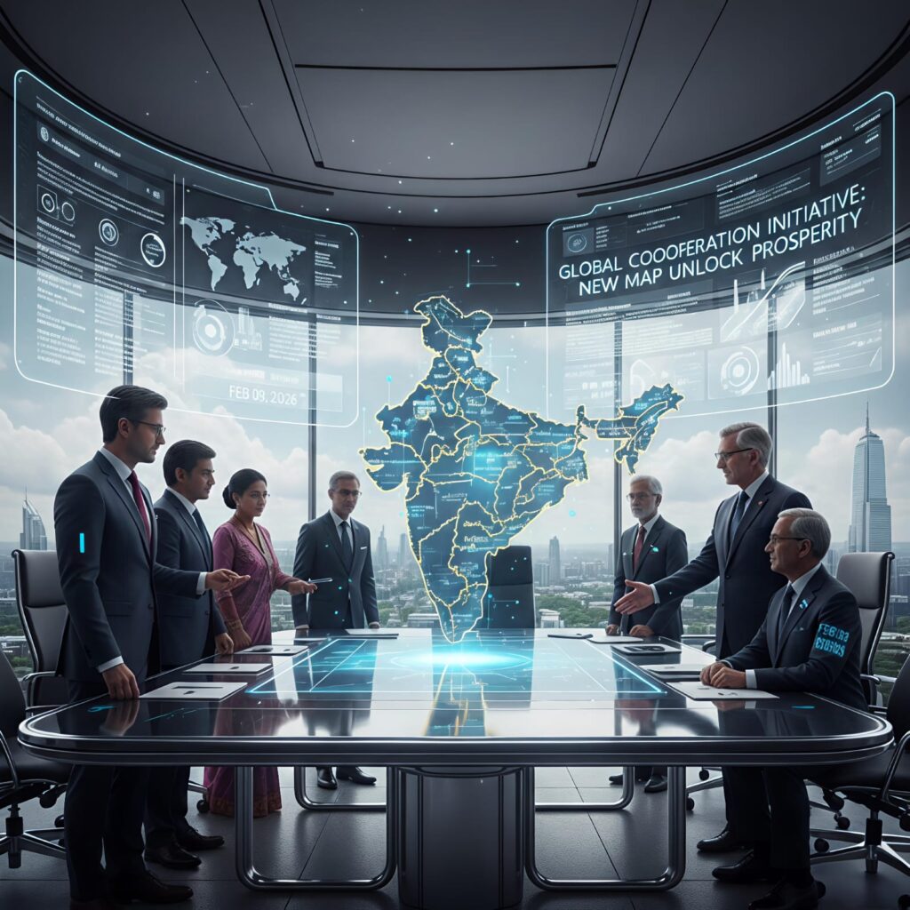
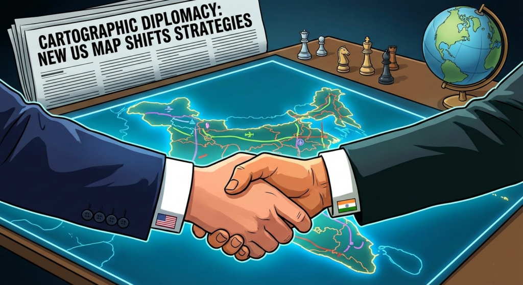
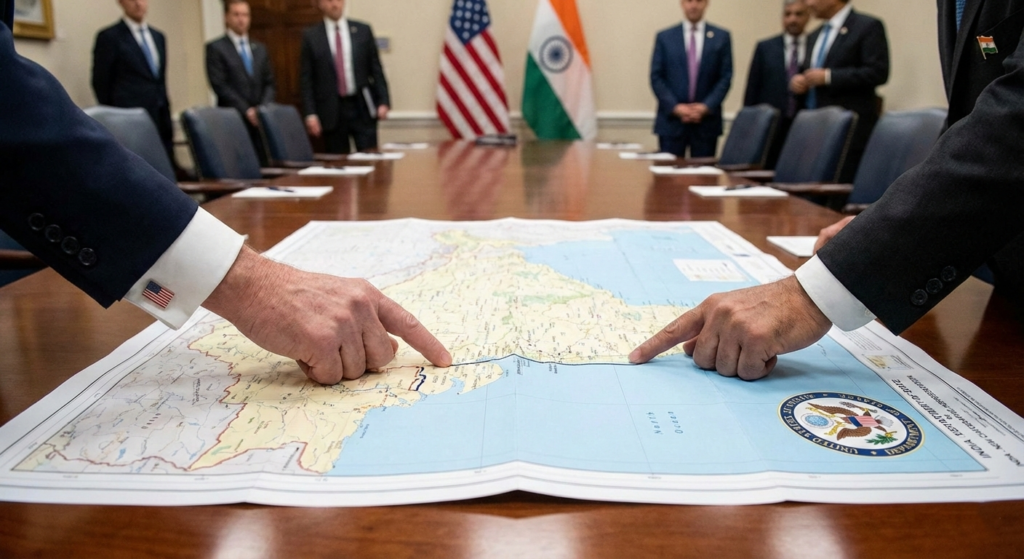
Maps are rarely just about geography. Instead, they serve as instruments of power and tools of political intent. On February 7, 2026, the United States released a graphic that did more than show a simple trade route. Specifically, it redrew the geopolitical reality of South Asia. By showing the entire territory of Jammu and Kashmir, including Pakistan-occupied Kashmir (PoK) and Aksai Chin, as part of India, Washington has ended decades of “cartographic neutrality.”
Consequently, this is not a simple mistake by a low-level staffer. On the contrary, cartographic diplomacy is the smart use of maps to signal big shifts in foreign policy. Therefore, it shows that the US is no longer trying to please every neighbor. Rather, it is backing India as the main leader in the Indo-Pacific. For years, experts watched dotted lines on maps with confusion. However, this new change is not a small shift; it is a total reset of global relations.
Understanding the Concept: What is Cartographic Diplomacy?
Before we dive into the details, we must define the core term. Cartographic diplomacy refers to the practice of using maps to assert sovereignty or signal diplomatic support. Historically, nations have used maps to claim land they do not yet control. For example, China has used “map warfare” for years to claim the South China Sea.
Specifically, when a superpower like the US changes its map, the world takes notice. This is because official maps dictate everything from airline routes to international business insurance. Furthermore, these maps influence how the next generation of students views the world. Indeed, if a child in New York sees a map where PoK belongs to India, that child grows up accepting it as a fact.
Why the New US Map of India is a Game Changer Now
Notably, the timing of this release is perfect. As the US seeks to “de-risk” from China, it needs a strong, stable partner in Asia. By recognizing India’s full borders, the US is providing the ultimate “seal of approval.” Consequently, this makes India a more attractive place for long-term Western projects. In addition, it sends a clear message to rivals that the US-India bond is no longer just about trade; it is about shared territory and truth.
The End of “Strategic Ambiguity”
To understand why this matters, we must look at the past. For over seventy years, the US used a policy called “strategic ambiguity” regarding India’s borders.
The Old Way: Dotted Lines and Doubts
In the past, US maps were very cautious. Usually, they showed the Line of Control (LoC) with dotted lines. Furthermore, they used different colors for “disputed areas.” This was a result of Cold War politics. During that time, the US needed to keep Pakistan happy to counter the Soviet Union.
The “Disputed” Label: Old maps labeled Kashmir as a “dispute.” As a result, this gave weight to Pakistan’s claims.
The Aksai Chin Blur: The border with China was also left unclear. Consequently, this ignored China’s illegal control over the area.
The New Way: Clear and Bold Borders
The world has changed. Now, the US sees India as its most important partner against China. Therefore, the new map matches India’s official stance perfectly. Specifically, the map includes:
Gilgit-Baltistan: These northern areas are now shown as Indian land.
Aksai Chin: Land held by China is now marked within India’s borders.
Arunachal Pradesh: The map shows the northeast is strictly Indian, rejecting Chinese names for the region.
This visual change is as strong as a signed treaty. Furthermore, it tells the world that India’s land is not up for debate.
The China Factor: Countering “Map Warfare”
Why did the US make this move now? The answer is simple: to stop China’s aggressive “map warfare.” Specifically, China is famous for changing maps to suit its needs. They rename towns in India and claim the whole South China Sea. They do this to slowly take land, a move called “salami slicing.”
Stopping the Salami Slicing
By using the New US Map of India, Washington is playing the same game but for the side of democracy. Consequently, this move hurts China in two big ways:
The McMahon Line Recognition
Historically, China has claimed that the McMahon Line is a colonial relic. However, the US now recognizes this line as the real border. Therefore, any Chinese move across this line is now an invasion, not a “skirmish.” This protects the northeast of India.
The Aksai Chin Strategic Trap
Notably, a major Chinese military road runs through Aksai Chin. Since the US now calls this Indian land, that road is technically illegal. Furthermore, this gives the US a reason to put pressure on China’s military moves in the future. Indeed, it frames China as a squatter on Indian soil.
The Impact on Trade and CPEC
Perhaps the biggest hit is to the China-Pakistan Economic Corridor (CPEC). This is China’s huge project in Pakistan. Specifically, it is meant to link China to the Arabian Sea.
Is CPEC Built on Stolen Land?
CPEC goes through Gilgit-Baltistan. Crucially, the New US Map of India says this land belongs to India. If the US says the land is Indian, then CPEC is a project built on stolen land without the owner’s permission.
Insurance Problems: Global banks might stop insuring these projects.
Loan Issues: The US can tell the IMF not to give money to Pakistan if it is used for “illegal” projects in PoK.
Consequently, this map makes China’s investment very risky. In addition, it forces other countries to think twice before joining China’s “Belt and Road” projects in the region.
Pakistan’s New Reality: Diplomatic Isolation
For Pakistan, this map is a total disaster. Historically, they always wanted the US to help them with Kashmir. However, this map shows that the US has finally picked a side.
No More Neutrality
Pakistan can no longer say the world agrees that Kashmir is “disputed.” The US has visually said it is not. Furthermore, this pushes Pakistan further away from the West and closer to China. This makes Pakistan more lonely on the global stage.
Specifically, this shift changes the narrative in the United Nations. If the US recognizes the map, other Western allies might follow. Therefore, Pakistan’s claim to the region loses its international legal standing.
The Digital War: Google and Apple Maps
The next step for cartographic diplomacy is on your phone. Most people use Google Maps or Apple Maps every day.
The Tech Push
Right now, Google shows different borders depending on where you live. For example, if you are in Delhi, you see one map. If you are in London, you see another. However, India can now use the US map to force these companies to change.
Specifically, if the US government officially uses the map, US-based tech firms must listen. If Google Maps shows one solid border for India everywhere in the world, India wins the argument. Indeed, digital maps are the most powerful maps in history.
Economic Implications: Why Investors Care
You might think maps don’t affect money. However, the opposite is true. In global finance, “sovereignty” equals “safety.”
FDI and the Border Regions
Historically, foreign direct investment (FDI) stayed away from Jammu, Kashmir, and Arunachal Pradesh. This was because the “disputed” label made the regions look like war zones.
New Confidence: With the US backing the map, American companies will feel safer.
Supply Chain Security: If a company builds a factory in a region the US recognizes as India, they know the US will protect that interest.
Consequently, this map could lead to a boom in tourism and tech in the Himalayas. Furthermore, it integrates these regions into the global economy faster than ever before.
How India Can Win the Long Game
This map is a great start. But India must act now to make it permanent. India must show expertise and authority in managing these lands.
Step 1: Build More Roads and Dams
India should build more infrastructure in the areas the US now recognizes. Since the US agrees the land is Indian, there will be less global pushback. Specifically, high-speed internet and better roads in Gilgit-Baltistan (once reclaimed) and Arunachal would show control.
Step 2: Use “Lawfare”
India can sue companies that work in PoK. By using the New US Map of India as proof, India can claim these companies are breaking the law. Specifically, this could stop Chinese miners from taking resources from Indian soil.
Step 3: Get More Friends
India should ask France, the UK, and Japan to use the same map. If every major country does this, the old “disputed” maps will vanish forever. Therefore, India must lead a global movement to correct the world’s atlases.
The Role of Storytelling in Mapping
Every map tells a story. For years, the story was that India was a country with “broken” borders. However, the New US Map of India tells a story of a whole, united, and powerful India.
Changing the World’s Mind
When the US prints this map, it changes the mind of the “global middle.” These are people in Africa, South America, and Southeast Asia who don’t follow the conflict daily. They just see the lines. Specifically, when they see a solid India, they treat it as a solid power.
Indeed, this is the most powerful weapon in India’s diplomatic kit. It is a soft-power win that has hard-power results.
Potential Risks and Blowback
Of course, every game changer has risks. We must be honest about the challenges.
China’s Aggression
Notably, China may react by moving more troops to the border. They hate losing the “map war.” Therefore, India must be ready for more tension in Ladakh and Arunachal.
Pakistan’s Protest
Similarly, Pakistan will likely complain to the UN. However, without the US to back them up, their words will carry less weight. In contrast, they may try to use cyber-attacks to change digital maps.
Ultimately, the benefits of the New US Map of India far outweigh the risks. It is a bold move that defines the next fifty years of Asian history.
Practical Steps for You (The Reader)
How does this affect you? If you are a student, a business person, or just a citizen, you have a role.
Use the Right Map: When you make presentations or posts, use the official Indian map recognized by the US.
Report Errors: If you see a digital map with dotted lines, report it as “incorrect information.”
Educate Others: Explain to your friends why the New US Map of India is a game changer. Specifically, tell them it is about more than just land; it is about respect.
Conclusion: A New Era for India
The release of this map is not just ink on paper; it is a declaration of intent. Cartographic diplomacy has moved from the fringes of academic discussion to the center of the Oval Office. Specifically, the US has signaled that it trusts India’s vision for the future.
By aligning its cartography with India’s, the US has signaled that the future of Asia lies with New Delhi. The “dotted lines” of the past are gone. In their place is a solid line that represents strength, unity, and a shared democratic goal. Indeed, the New US Map of India is the most significant diplomatic win for India in this decade.
The message is clear. India’s borders are solid. Now, India must use this support to grow, lead, and stay strong in a changing world.
Frequently Asked Questions (FAQs)
Q1: Will this map start a war? Probably not. Maps are about talking and pressure. While it makes China and Pakistan angry, it does not mean the US is sending soldiers. Rather, it is about making their claims look “illegal” to the rest of the world.
Q2: Why did the US wait so long to change the map? In the past, the US needed Pakistan for the war in Afghanistan. Today, they need India to balance out China’s growing power. It is all about timing and new interests.
Q3: Does this help the Indian economy? Yes. It makes the border regions look safer for big business. Specifically, it encourages American companies to build factories in places they used to avoid.
Q4: Will Google Maps change its global view? India is likely to use this US map to pressure tech companies. While Google has been slow to change, having the US government on India’s side is a massive advantage.
Q5: Is this a “game changer” for Kashmir? Yes. It effectively ends the idea that the US will help Pakistan take Kashmir. It shows the world that the US views Kashmir as a closed case: it is Indian.